How Tectonic Forces Shaped the Continents – Explained by Geologists
The Dance of the Continents: Shaping Earth's Surface Over Billions of Years
The movement of Earth's continents has been a continuous process for billions of years, shaping the landscapes we see today. Scientists are uncovering new insights into how plate tectonics has formed our modern world, revealing unexpected findings that challenge previous assumptions about the formation of continents.
The Great Awakening: When Continents First Rose From Ancient Seas

Earth's first continents did not emerge through the plate tectonics we observe today. Around 5 billion years ago, the planet already had chemical traits associated with modern continents. This discovery suggests that the signatures of continental crust could form naturally without the need for plate tectonics. Through simulations of early Earth conditions, scientists found that the intense heat and molten environment of the planet's infancy created these features on its own.
This finding alters our understanding of Earth's evolution and may influence how we view crust formation on other planets. These initial episodes of continental emergence were driven by voluminous granitoid magmatism in non–plate tectonic settings, forming approximately 50-km-thick, silica-rich crust that rose above the oceans due to isostasy. This discovery changes our understanding of when land first appeared on Earth's surface.
The Hidden Volcanic Forge: How Ancient Magma Sculpted Continents
Scientists have discovered that subduction was not necessary to create Archaean zircons. Instead, these minerals could form through high pressure and temperatures associated with the melting of the Earth's thick primordial crust. "Using my calculations and models, you can get the same signatures for zircons and even provide a better match through the partial melting of the bottom of the crust," said Hernández Uribe.
During the Paleo-Mesoarchean, a flat and hot subduction was operated, which was more episodic with intermittent events due to frequent slab break-offs. In contrast, steep and relatively cold subduction with coherent and continuous slabs was observed since the Neoarchean. The evolving tectonic character is likely due to changes in mantle temperatures. The Archean crust is bimodal in nature, consisting of TTG gneisses and greenstone belts, while the post-Archean crust is andesitic in composition.
The difference in composition during the Archean and post-Archean periods is due to differences in tectonic processes, such as flat and steep subduction without and with mantle wedge. The ancient Earth operated under completely different rules than the modern planet. Recent studies suggest that approximately 60-70% of modern continental crust was formed in the Archean, with the remainder formed during the Proterozoic and Phanerozoic eras. In the late Proterozoic, the dominant supercontinent was Rodinia (~1000–750 Ma). This means most of our modern continental foundation was built during Earth's middle age, not in recent geological times.
When the Earth's Heart Started Beating: The Birth of Modern Plate Tectonics
Features like the oldest regional dyke swarms and major sedimentary basins, both at or after c. 8 Ga, indicate that Earth's crust was becoming rigid enough to support the massive forces of plate tectonics. Geodynamic models highlight that the subduction of one lithospheric plate below another requires a certain rigidity in the crust. Lithospheric strength is sensitive to lithospheric thickness and the amount and distribution of radiogenic heating.
Moreover, the lithosphere is weaker at higher temperatures, and it has been argued that plate tectonics may only take place once the mantle potential temperature is within c. 100°C of that at the present day. The transition to modern plate tectonics required Earth to cool down significantly from its scorching youth. The existence of stable continental blocks by the early Proterozoic allowed orogenic belts to develop at their margins by some form of collision tectonics. This was the first time that long, linear orogenic belts could form by "modern" tectonic processes involving seafloor spreading, ophiolite obduction, and subduction. The Proterozoic era marked the beginning of the continental collision processes that continue today.
The Continental Assembly Line: How Cratons Became Earth's Stable Foundation
TTG suites dominate the records of Archean cratons, and the stabilization of the cratons appears to be linked to the late-stage generation of granite and sanukitoids. Typically, granites are attributed to partial melting in response to crustal thickening, whereas sanukitoids are attributed to the introduction of crustal material via subduction into their source regions. Different cratons often have similar magmatic records but over different time periods, indicating that craton stabilization occurred at different times in different places.
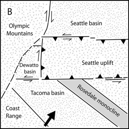
The vertical motions of the stable parts of continents, called cratons, remain one of the least understood aspects of plate tectonics. A team from the University of Southampton, including Dr. Thea Hincks, Dr. Derek Keir, and Alice Cunningham, collaborated with colleagues from the Helmholtz Centre Potsdam - GFZ German Research Centre for Geosciences and the University of Birmingham to address this fundamental question. Their results help explain why parts of the continents previously thought of as "stable" experience substantial uplift and erosion, and how such processes can migrate hundreds or even thousands of kilometers inland, forming sweeping elevated regions known as plateaus, like the Central Plateau of South Africa. Even the supposedly stable cores of continents are more dynamic than scientists previously realized.
The Great Breakup: How Pangaea's Death Created Modern Geography
The supercontinent Pangaea formed around 335 million years ago and existed between 320 million and 195 million years ago. Pangaea broke up in several phases between 195 million and 170 million years ago. The breakup began in the early Jurassic period, when the Central Atlantic Ocean opened. The supercontinent fractured largely along previous sutures, with Gondwana (what is now Africa, South America, Antarctica, India, and Australia) splitting from Laurasia (Eurasia and North America).
The death of Pangaea wasn't a single catastrophic event but a gradual process spanning tens of millions of years. A recent study published in the Journal of Geophysical Research: Solid Earth sheds new light on the formation of the East Coast of the United States—a "passive margin," in geologic terms—during the breakup of the supercontinent Pangea and the opening of the Atlantic Ocean around 230 million years ago. The breakup of Pangaea directly shaped the coastlines we see today, including America's eastern seaboard. This is thought to have reduced dissolved oxygen levels in the warm water habitats that remained and contributed to the 95 percent reduction of diversity in marine species.
Pangea's breakup had the opposite effect: more shallow water habitat emerged as overall shoreline length increased, and new habitats were created as channels between the smaller landmasses opened and allowed warm and cold ocean waters to mix. On land, the breakup separated plant and animal populations, but life-forms on the newly isolated continents developed unique adaptations to their new environments over time, and biodiversity increased. The formation and breakup of supercontinents directly controls the evolution of life on Earth.
The Hidden Forces: Deep Earth Waves That Lift Continents
The new research, led by the University of Southampton, examined the effects of global tectonic forces on landscape evolution over hundreds of millions of years. The findings are published today (07/08/2024) in the journal Nature. Tom Gernon, Professor of Earth Science at the University of Southampton and lead author of the study, said: "Scientists have long suspected that steep kilometre-high topographic features called Great Escarpments—like the classic example encircling South Africa—are formed when continents rift and eventually split apart. However, explaining why the inner parts of continents, far from such escarpments, rise and become eroded has proven much more challenging."
They have found that when tectonic plates break apart, powerful waves are triggered deep within the Earth that can cause continental surfaces to rise by over a kilometer. Their findings help resolve a long-standing mystery about the dynamic forces that shape and connect some of the Earth's most dramatic landforms—expansive topographic features called 'escarpments' and 'plateaus' that profoundly influence climate and biology. Building on this, the team modeled how landscapes respond to this mantle-driven uplift. They found that migrating mantle instabilities give rise to a wave of surface erosion that lasts tens of millions of years and moves across the continent at a similar speed. This intense erosion removes a huge weight of rock that causes the land surface to rise further, forming elevated plateaus. Deep within Earth, waves of geological change are constantly reshaping the continents above.
The Mountain Destroyers: How Continental Collisions Recycle Crust
Dr. Zhu states, "Our research quantifies the amount of Earth's crust lost to the mantle during continental collisions, such as those forming the Himalayas." Dr. Zhu explains that delamination is the likely mechanism responsible for crustal recycling during the formation of the Himalayan-Tibetan Plateau. Specifically, since the onset of the Himalaya-Tibetan Plateau formation approximately 50-55 million years ago, plate reconstructions suggest India and Asia have converged by ~3,000 km, though only 1,000-2,000 km of this can be attributed to crustal shortening. The remainder is considered to have not been preserved in the rock record but attributed to a portion of continental crust that was subducted or delaminated into the mantle, known as Greater India. Meanwhile, the European Alps orogeny began forming around 35 million years ago, with half of the crustal volume potentially being destroyed. Continental collisions are not just mountain-building events but also massive recycling operations that destroy as much crust as they create.
Europe and North America: Still Breaking Apart After 52 Million Years
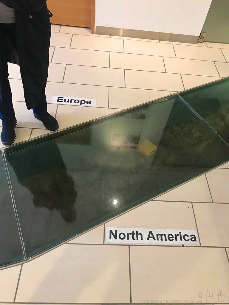
The findings mean that, contrary to the traditional model for the formation of Iceland and the Greenland Iceland Faroes Ridge (GIFR), scientists now believe that the break-up of the European and North American continents is still ongoing. "The discovery indicates that the North American and Eurasian tectonic plates have not yet actually broken apart, as is traditionally thought to have happened 52 million years ago." Controversially, this discovery sparks a debate over exactly how many continents officially exist in the world, as based on these findings, scientifically speaking North America and Europe could be classed as one, not two. Meanwhile, Dr. Phethean, together with researcher Luke Longley from the University of Derby, were part of a team that recently discovered a new proto-microcontinent believed to have formed 60 million years ago.
The proto-microcontinent is located between Canada and Greenland and is 250 miles long—about the same size as England. It currently sits below the Davis Strait, which connects the Labrador Sea in the south with Baffin Bay to the north. Its discovery was made using gravity data collected by space satellites and seismic reflection data—similar to a giant ultrasound scan of the Earth. Hidden continents lie beneath our oceans, testament to the ongoing process of continental breakup and formation.
The Continental Time Machine: Reconstructing 1.8 Billion Years of Movement
8 billion years. It is the first time Earth's geological record has been used like this, looking so far back in time. This has enabled us to make an attempt at mapping the planet over the last 40% of its history, which you can see in the animation below. The work, led by Xianzhi Cao from the Ocean University in China, is now published in the open-access journal Geoscience Frontiers. Modeling our planet's past is essential if we're to understand how nutrients became available to power evolution. 65 billion years ago. This is near the start of this reconstruction and close to the time the supercontinent Nuna formed. We aim to test whether the mountains that grew at the time of Nuna formation may have provided the elements to power complex cell evolution.
The timing of continental formation and the evolution of complex life are intimately connected. Mapping the past plate tectonics of the planet is the first stage in being able to build a complete digital model of Earth through its history. Such a model will allow us to test hypotheses about Earth's past. For example, why Earth's climate has gone through extreme "Snowball Earth" fluctuations, or why oxygen built up in the atmosphere when it did. Indeed, it will allow us to much better understand the feedback between the deep planet and the surface systems of Earth that support life as we know it. These groundbreaking discoveries reveal that plate tectonics didn't just build our continents but continues to reshape them in ways scientists are only beginning to understand.
From the earliest protocrusts that formed without modern plate tectonics to the hidden forces still pulling Europe and North America apart, our planet's continental dance continues to surprise researchers. The story of how Earth's surface came to be is far more complex and fascinating than anyone imagined just decades ago.
Post a Comment for "How Tectonic Forces Shaped the Continents – Explained by Geologists"
Post a Comment