
Florida Braces for Triple Weather Threat: Nor'easter, King Tides, and Cold Front
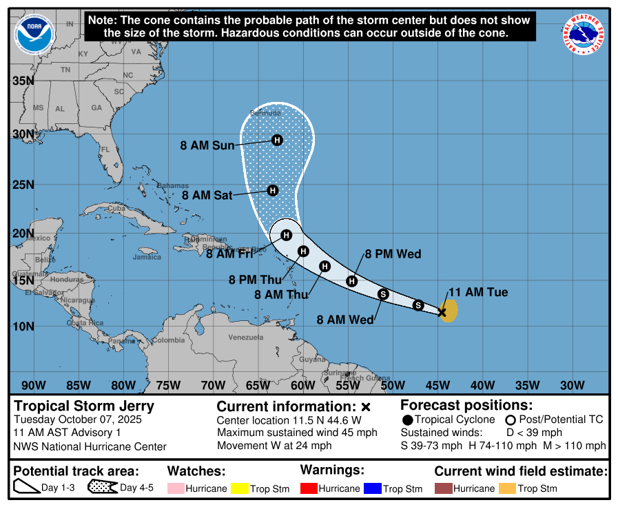
Florida Faces a Triple Threat: Nor'easter, Tropical Storm Jerry, and King Tides
Florida is bracing for a series of weather events that could impact the state over the next few days. The combination of a "Nor'easter," Tropical Storm Jerry, and king tides is creating a complex situation for residents and officials alike. Additionally, a cold front is expected to move through the region, adding another layer of uncertainty.
Cold Front Approaching Florida
A cold front is set to move through North Florida on Thursday, October 9, bringing isolated showers and occasional thunderstorms. It will then progress southward, reaching Central Florida by Friday and South Florida by Saturday. While this front won't bring freezing temperatures, it will usher in cooler and drier air that will last into early next week.
The National Weather Service Tallahassee reported that high temperatures on October 8 will range from the upper 80s to near 90 degrees Fahrenheit. However, the humidity will make it feel like the mid-90s to near 100 degrees. As the cold front moves in, temperatures are expected to drop gradually.
Low temperatures this week are expected to vary across the state:
- Wednesday: Low temperatures will fall into the upper 60s to lower 70s across North Florida, middle 70s in Central Florida, and upper 70s to lower 80s in South Florida. Some areas in the western Panhandle could see temperatures as low as the 50s.
- Thursday: Lows will be in the middle to upper 60s in North Florida, lower to middle 70s in Central Florida, and upper 70s in South Florida. The NWS Tallahassee predicts lows in the 50s on Friday and into the weekend.
- Friday and Saturday: Lows will range from lower to middle 60s in North Florida, upper 60s to lower 70s in Central Florida, and lower to middle 70s in South Florida.
Nor'easter Develops Off East-Central Florida
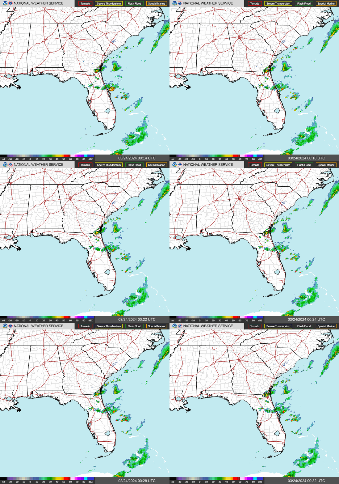
A long-duration Nor'easter is expected to develop off the east-central Florida coastline by the weekend. This storm system will bring breezy conditions and dangerous surf to the eastern coast of the state.
According to the Florida Department of Emergency Management, an area of non-tropical low pressure will form just offshore the East-Central Florida coastline. It will then move north along the East Coast of the U.S., bringing gusty northeasterly winds to North Florida and extending along the northern half of the East Coast.
Wind speeds are expected to reach 15-20 mph in inland areas, with stronger winds of 20-30 mph near the Northeast Florida coast. Wind gusts upward of 15-20 mph are possible farther inland, while gusts of 20-40 mph may occur closer to the coast. Wind advisories might be issued for the Northeast Florida coast beginning Thursday afternoon and evening.
The National Weather Service Jacksonville warns of:
- A coastal flood watch for the Atlantic Coast and St. Johns River Basin, with moderate tidal flooding possible.
- A gale watch for Atlantic waters from Thursday afternoon through Saturday night.
- High surf and wind advisories likely for coastal locations Thursday through Friday.
- Heavy downpours and isolated thunderstorms along the I-95 corridor Thursday and Friday.
- Destructive beach erosion possible at area beaches through the weekend.
What Is a Nor'easter?
A Nor'easter is a storm along the East Coast of North America, named for the northeast winds that typically affect the coastal area. These storms generally move northeastward and attain maximum intensity near New England and the Maritime Provinces of Canada.
During winter, the polar jet stream transports cold Arctic air southward and then eastward toward the Atlantic Ocean. Warm air from the Gulf of Mexico and the Atlantic tries to move northward, creating a temperature contrast that fuels these storms. The warm waters of the Gulf Stream help keep coastal waters relatively mild during the winter, which in turn warms the cold winter air over the water. This temperature difference is the fuel that feeds Nor'easters.
King Tides Bring Dangerous Beach Conditions
King tides are causing minor coastal flooding and rough surf along Florida's east coast. High tides are expected to be 1 to 3 feet above normal, with rough surf of 4-5 feet along east-central Florida beaches. In Northeast Florida, breakers could reach 4-6 feet.
Moderate tidal flooding — 2-3 feet above normally dry ground — is likely along the Atlantic coast, Intracoastal Waterway, and St. Johns River Basin through the weekend. A coastal flood advisory remains in effect along the east coast as the influence of the king tides continues.
Tropical Storm Jerry’s Impact on Florida
Tropical Storm Jerry is not expected to pose a direct threat to Florida. However, it may bring ocean swells and rip currents late this weekend and into early next week. Residents should remain cautious of changing conditions and stay informed about potential updates.
Stay Informed
To receive weather alerts via text, sign up for updates about current storms and weather events by location. Follow local news sources for the latest information on tropical weather and other developments.
What’s Next?
Weather conditions will continue to evolve, and updates will be provided daily as needed. Download your local site's app to stay connected to the news and look for special subscription offers.
For more information on watches, warnings, and storm tracking, visit the relevant resources.

Post a Comment for "Florida Braces for Triple Weather Threat: Nor'easter, King Tides, and Cold Front"
Post a Comment